Across the Northeast and Mid-Atlantic, flash flood warnings have been issued, putting major cities like New York City, Philadelphia, and Washington, DC, at risk from heavy rainfall. These urban areas are extremely vulnerable to dangerous flooding during the next 24 hours, according to meteorological authorities.
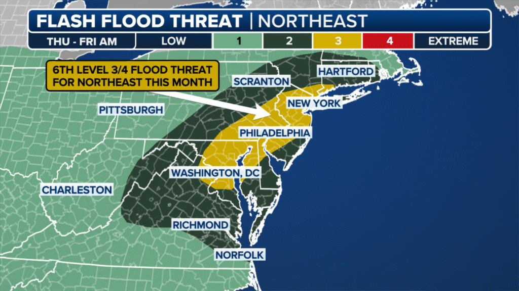
- Flood Risk Level: These areas, particularly the I-95 corridor that connects Washington, DC, to New York City, are at Level 3 out of 4 risk for flooding, according to the National Weather Service’s Weather Prediction Center. Approximately 23 million people are covered by this.
- Timing: Thursday night and Friday morning are predicted to see the most intense rainfall. Warnings and watches for flash floods are already in effect.
- Anticipated Rainfall: In the impacted areas, 3 to 5 inches of rain are anticipated, with isolated areas possibly receiving up to 7 inches. Where thunderstorms last for several hours, the amount of rainfall will be at its highest.
- Geographic Impact: Washington, DC, Baltimore, Philadelphia, northern New Jersey, and southern New York, including New York City, are all in the highest risk zone.
- Risks Beyond Flooding: In addition to flash flooding, the storms may bring hail and destructive winds. There may be tree damage and power outages.
- Impact on Commuters and Travel: Long travel delays are expected, especially during rush hour. Even at shallow depths, flooded roads can be deceptively dangerous, so authorities advise against driving on them.
- Emergency Response: Local and state governments are keeping a careful eye on the situation and preparing emergency responses as a result of the Flood Watches and Warnings that are in effect for a large portion of the region.
- Weather Pattern: A powerful, slow-moving cold front interacting with extremely humid air is the cause of the frequent, intense thunderstorms. The weekend is expected to bring relief from the heat and a return to drier conditions.
Safety advice emphasizes:
- Use local news and weather apps to stay informed about advisories and warnings.
- Avoid traveling when it’s raining a lot or if the routes are known to be prone to flooding.
- A car can float in even a foot of water, so never try to cross flooded roads.
- If you reside in a vulnerable area, be ready for potential power outages or service interruptions.
The Northeast has now experienced a Level 3 flash flood risk six times in July, highlighting the area’s continued susceptibility to powerful summer storms in 2025.
For the most recent information on flash flood conditions and suggested precautions, residents are urged to keep an eye on updates from the National Weather Service and local emergency management.